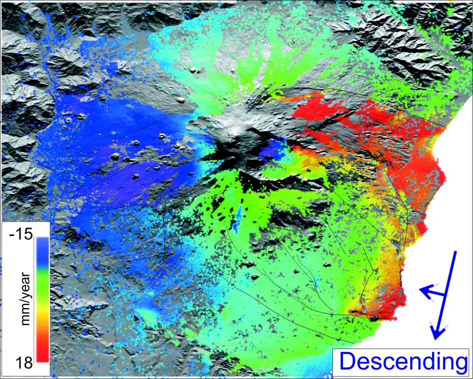
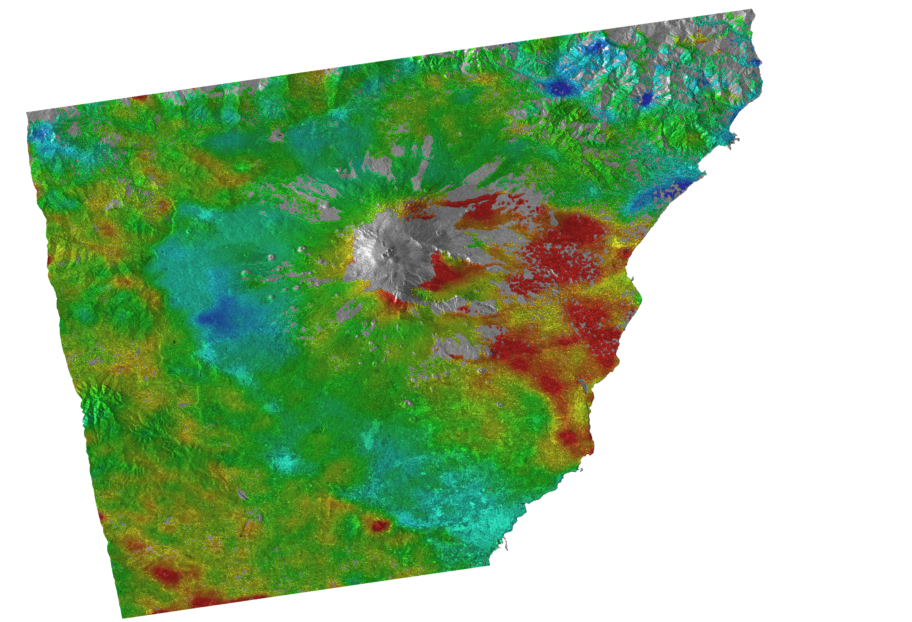
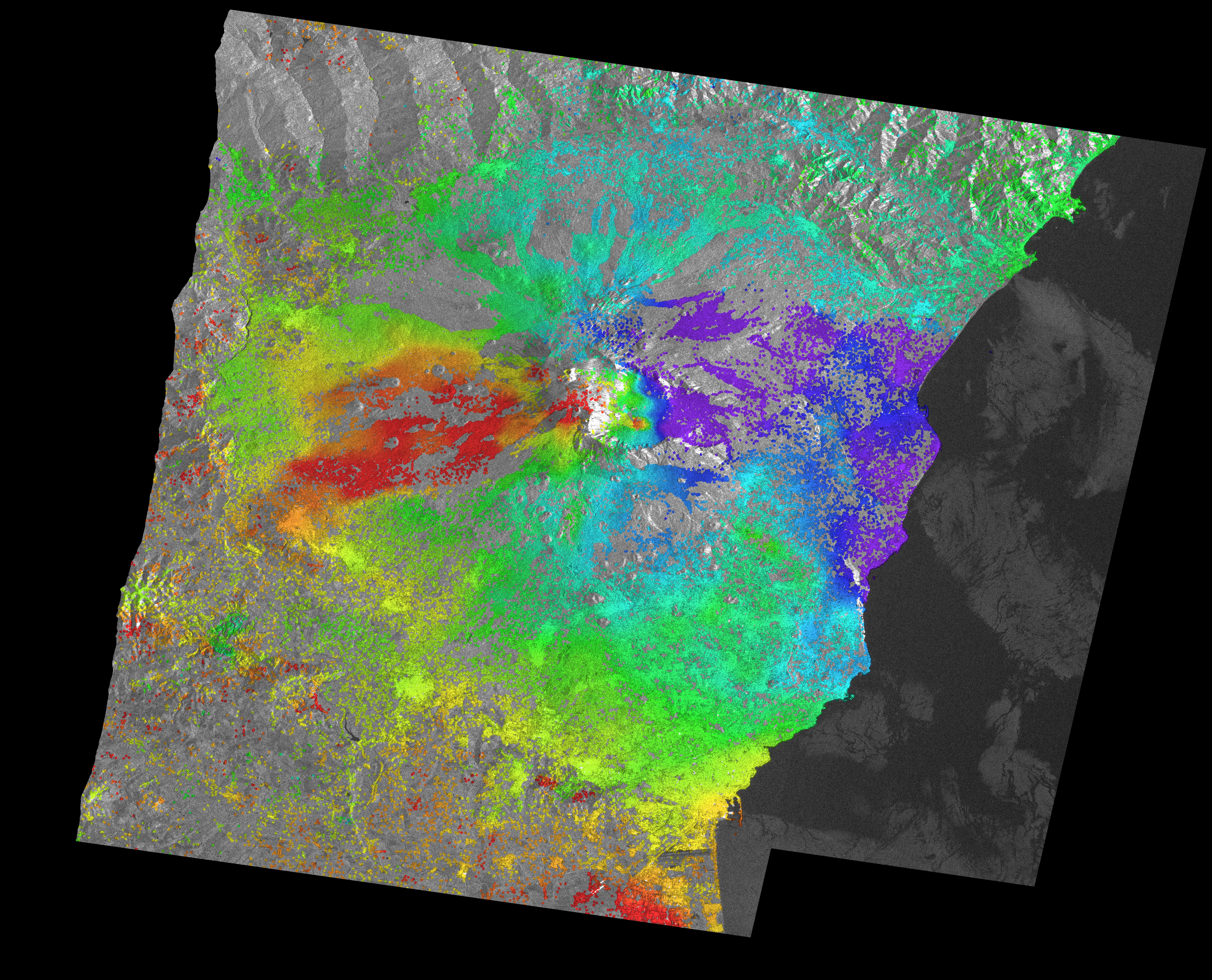
This interactive map provides access to EU Copernicus Sentinel-1 A-DInSAR products made by INGV-OE Remote Sensing Lab. SENTINEL 1 TOPSAR data are provided by ESA to Mt. Etna Volcano Supersite, in the frame of GEO-GSNL initiative. Data were processed by the GAMMA software, using a spectral diversity method and a procedure able to co-register the TOPSAR SLC pairs with extremely high precision (< 0.01 pixel). The DInSAR results are analysed and successively used as input for the time series analysis using the StaMPS package (Hooper, 2008). In order to optimize the time processing, a new software architecture based on the hypervisor virtualization technology for the x64 versions of Windows has been implemented.
All Sentinel-1 results that are available for download are Derived Works of Copernicus data (2015-2016), subject to the following use conditions: "Terms and conditions for the use and distribution of sentinel data and service information".
This service has been implemented in the frame of INGV-FISR project (Sale Operative integrate e Reti di Monitoraggio del futuro: l’INGV 2.0)
Please cite the following publication if you use data from this service:
Guglielmino, Francesco; Bonforte, Alessandro; D'Agostino, Marcello; Puglisi, Giuseppe (2016). Mt. Etna Ground deformation imaged by SISTEM approach using GPS data and SENTINEL-1A TOPSAR data. ESA Living planet symposium, Prague, 2016, HAZA-113 Poster Session